Tight schedule
Short loop
Up and down
- UpEl Peral
- AcrossPaseo Yugoslavo
- DownReina Victoria
Choose your stop
Colorful, Historic, and Panoramic Valparaíso
★ 4.8 · 99 guest ratings
Map of 45 stops
Pick a route and tap a pin or a stop: you get its note and a Google Maps link.
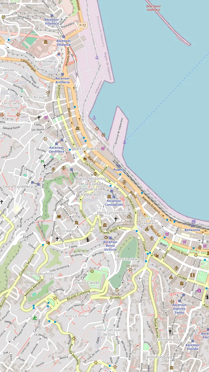
The civic square of the port, with the monument to the heroes of Iquique.
Google MapsThe pier for the short boat rides around the bay.
Google MapsLower station of the El Peral lift on Plaza de la Justicia, the classic way up to Paseo Yugoslavo.
Google MapsThe Fine Arts Museum in a palace on Paseo Yugoslavo.
Google MapsA narrow lane of murals with cafés and craft shops.
Google MapsPainted steps rising from Urriola street into Cerro Concepción.
Google MapsUpper station of the Reina Victoria lift, with a wooden footbridge and street art all around.
Google MapsSteps painted as piano keys in Pasaje Beethoven, beside the Lutheran church.
Google MapsThe Lutheran Church of the Holy Cross, one of the landmarks of the European-built hills.
Google MapsA cobbled balcony of colorful 19th-century facades above the city.
Google MapsThe viewpoint at the top of the Concepción lift, busy on New Year's Eve.
Google MapsLower station of the Concepción lift on Calle Prat, the oldest in the city.
Google MapsA busy square in the flat city below Cerro Concepción, near the Reina Victoria lift.
Google Maps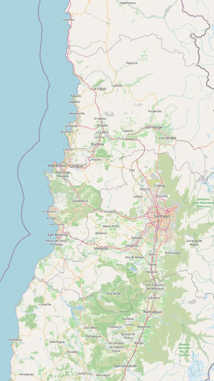
Chile's main international airport, west of central Santiago; official transport counters wait at the exit of Terminal 2.
Google MapsOne of the Santiago bus terminals with frequent departures for the coast.
Google MapsAnother Santiago terminal the tourism board names for Valparaíso buses, beside the coastal highway.
Google MapsThe first of the two trunk toll plazas on Route 68, where cars pay the posted toll.
Google MapsWine and olive oil country on the way west; the day tour stops in this valley for a tasting.
Google MapsThe second trunk toll plaza and tunnel, on the climb out of the Curacaví valley.
Google MapsThe town at the heart of the Casablanca wine valley, roughly midway along the highway.
Google MapsValparaíso's intercity bus terminal, across from the Congress building.
Google MapsThe western end of the Limache-Puerto train, a short walk from Plaza Sotomayor.
Google MapsThe Viña del Mar stop on the same line, for the beaches and the Flower Clock.
Google Maps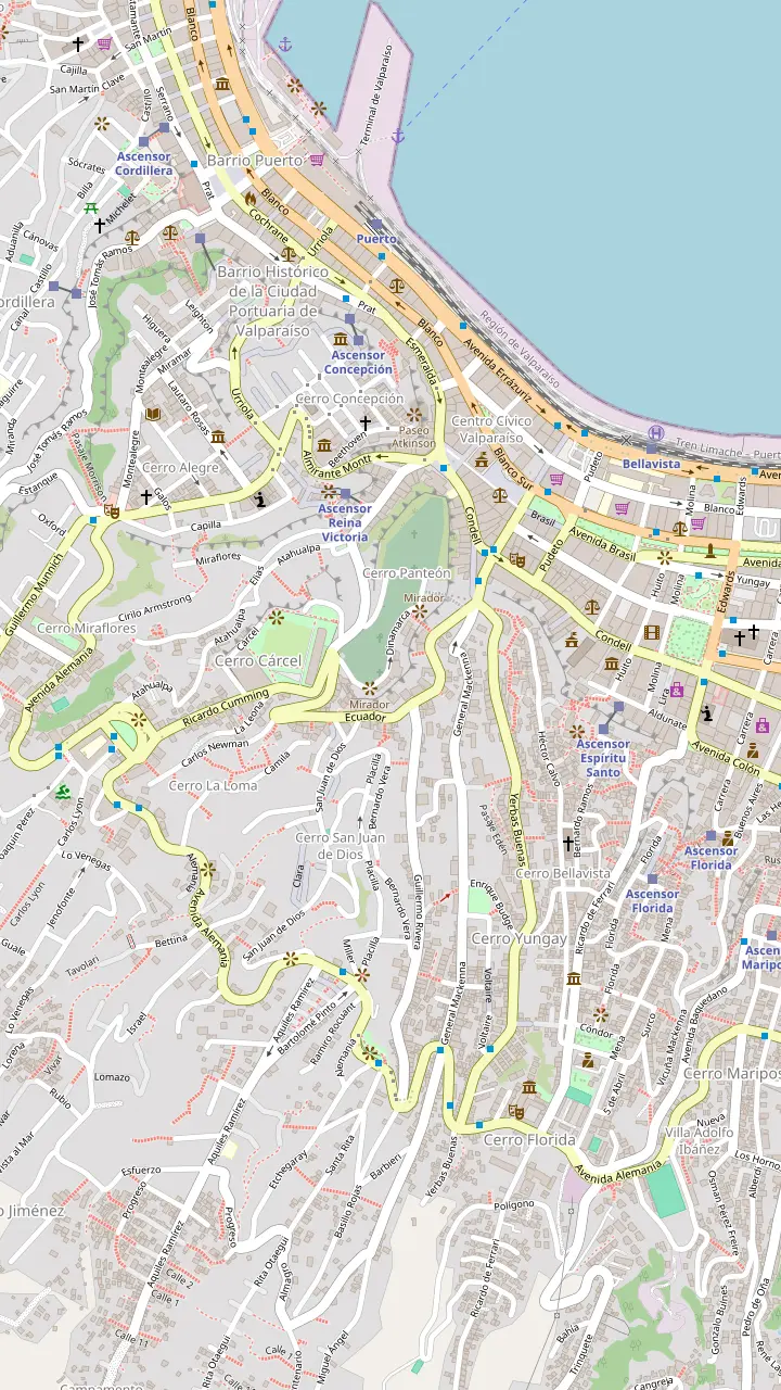
Painted steps rising from Urriola street into Cerro Concepción.
Google MapsSteps that carry the painted message about unity, at the edge of Cerro Alegre.
Google MapsA narrow stair beside the Fischer steps lettered with lines from a Calle 13 song.
Google MapsA narrow lane of murals with cafés and craft shops.
Google MapsStepped Templeman street, painted from bottom to top and home to the famous hippies line.
Google MapsSteps painted as piano keys in Pasaje Beethoven, beside the Lutheran church.
Google MapsUpper station of the Reina Victoria lift, with a wooden footbridge and street art all around.
Google MapsThe lift up to Cerro Bellavista, whose top exit leads to the Open Sky Museum.
Google MapsThe circuit of murals on Cerro Bellavista known as the Open Sky Museum.
Google MapsPlaza de los Poetas, a pause on the way between the murals and La Sebastiana.
Google MapsPablo Neruda's house museum, with views over the whole bay.
Google Maps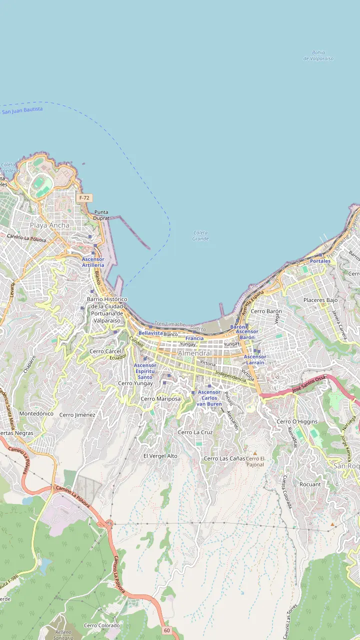
Lower station of the Concepción lift on Calle Prat, the oldest in the city.
Google MapsLower station of the Reina Victoria lift on Calle Elías, below Paseo Dimalow.
Google MapsLower station of the El Peral lift on Plaza de la Justicia, the classic way up to Paseo Yugoslavo.
Google MapsThe second-oldest lift in the city, in the old port quarter.
Google MapsThe lift that climbs a side ravine, the only one with no sea view.
Google MapsThe lift up to Cerro Bellavista, whose top exit leads to the Open Sky Museum.
Google MapsThe first lift with an electric motor, from Avenida España up to a viewpoint.
Google MapsThe only vertical lift, reached through a tunnel; temporarily closed.
Google MapsThe longest-running ride up to Paseo 21 de Mayo; temporarily closed.
Google Maps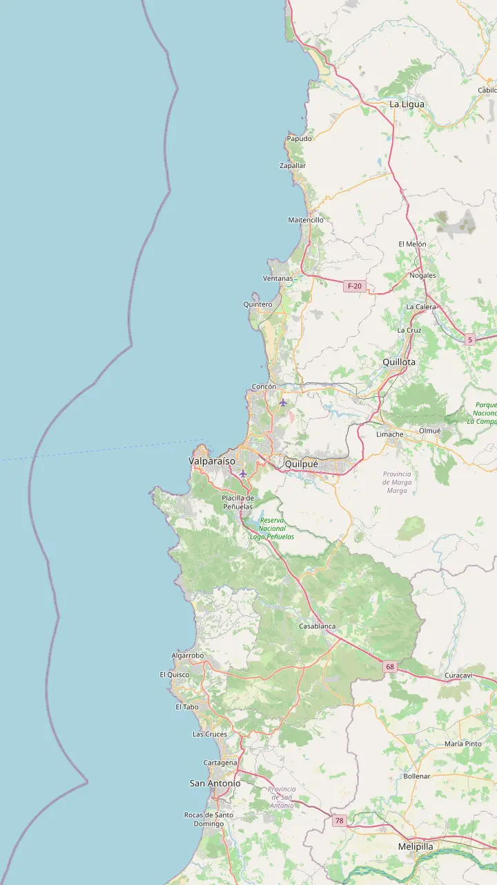
Boutique hotels, restaurants and galleries along the funicular hill.
Google MapsThe neighboring hill of viewpoints, churches and guesthouses.
Google MapsMurals, Neruda's house and small hostels above the Plaza Victoria side of the city.
Google MapsViña del Mar's floral clock, a classic first stop in the Garden City.
Google MapsThe seaside castle on the rocks between Viña and Caleta Abarca.
Google MapsViña del Mar's busiest beach resort, with ceviche restaurants and nightlife.
Google MapsThe rocky headland at Concón, a stop on the day tour from Santiago.
Google MapsThe islet off Cachagua that protects colonies of Humboldt penguins.
Google MapsNeruda's house museum on the Poets' Coast, where he and Matilde Urrutia are buried.
Google MapsThe town at the heart of the Casablanca wine valley, roughly midway along the highway.
Google MapsMaps © OpenStreetMap contributors
This Valparaiso walking tour starts by the water, rides a funicular into the heritage hills, crosses the classic viewpoints and painted stairs and comes back down by another lift, with every stop on the map.
Editorial team, valparaisotour.com · Updated November 11, 2026 · ~6 min read
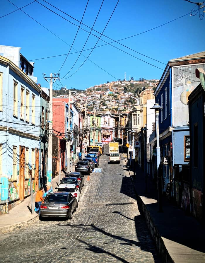
Every good Valparaiso walking tour begins at sea level. Plaza Sotomayor is the civic and historical heart of the city, where the main celebrations take place.1 The Monument to the Heroes of Iquique, from 1879, dominates the square, with the imposing Chilean Navy headquarters beside it.6 Stand with your back to the monument and you can see the hills you are about to climb.
Muelle Prat, the pier for boat rides around the bay, is just a 3-minute walk away.7 The municipal guide says the rides last about 30 minutes and cost from CLP 5,000 on a shared boat to CLP 40,000 for a private boat for up to 6 people.8,9 A ride first thing gives you the whole amphitheater of hills in one look, which makes the climb easier to picture.
This is also the old port quarter, where the city was born.10 Many of the buildings around you belong to the World Heritage area UNESCO declared in 2003.11 Take a few minutes to look at the facades of banks, trading houses and consulates before you head for the lift, because the story of the hills starts with the money that was made down here.
What you pass
| Stop | Hill | Why stop |
|---|---|---|
| Plaza Sotomayor | Flat city | Civic heart of the port1 |
| Muelle Prat | Waterfront | Boat rides around the bay7 |
| Paseo Yugoslavo | Alegre | View and fine arts palace21 |
| Paseo Dimalow | Alegre | Footbridge and murals12 |
| Piano stairs | Concepción | Painted keys by the church13 |
| Paseo Atkinson | Concepción | English and German facades14 |
| Paseo Gervasoni | Concepción | Top of the oldest lift3 |
Stops from the tourism board's hill walk and the city's tourism office pages.17
Walk to Plaza de la Justicia, at the back of the square, exactly as the tourism board's own hill walk does.17 The El Peral lift climbs from there to Paseo Yugoslavo: a ride of 55 m at 48 degrees that lasts 45 seconds.18,2 It opened in 1901.19
At the top, Paseo Yugoslavo was one of the first viewpoints of the hills and remains one of the busiest.20 It looks straight down on Plaza Sotomayor and the cranes of the port. Beside it stands the Palacio Baburizza, home of the Museum of Fine Arts, declared a National Monument in 1979.21,22
The tourism board lists entry to the fine arts museum as free, which makes it an easy first stop if the morning is cold or gray.23 Even if you skip the collection, look at the building itself, a grand merchant palace that sums up the wealth of the merchant families who lived on these hills. Then follow the lanes behind it into Cerro Alegre.
Cerro Alegre takes its name from the gardens of some of its houses, and you will still glimpse flowers behind gates and over walls.27 Head up Almirante Montt street, where the grandmother mural by Ella & Pitr watches the city from a house corner.28 Cafés, galleries and small shops line the way, so this is the place for a coffee.
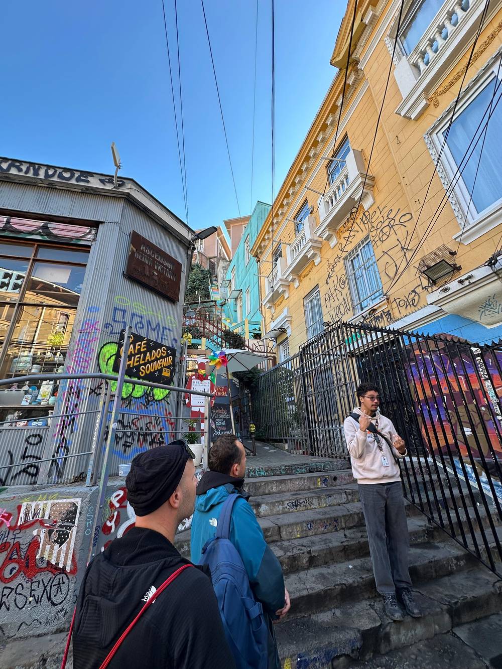
Continue to Paseo Dimalow, reached from the top of the Reina Victoria lift, where a wooden footbridge looks out over the coast.12 Street art surrounds the upper station, and the viewpoint gives you a fresh angle on the bay. If your legs are tired, this is your escape route: the lift drops 30 m to Calle Elías in 40 seconds.25,29
Look across the gully from here and you will see Cerro Concepción, your next hill, with its church spires and stacked houses. The neighboring hills are joined by footpaths and short stairs, and the boundary between them is not obvious on the ground. Use the map pins to keep your bearings: the streets twist, change level and sometimes end in a staircase without warning.
On your own?
Decide by what you want to take home.
If I want photos at my own pace
Walk alone with this map
Every stop has a pin and a Google Maps link.
If I want the history behind the houses
Book a guided walk
A 2.5-hour guided walk, with English among its languages.
If I want the main sights together
A 3-hour sights walk
It meets in front of the Hotel Reina Victoria.
If I want art explained by its makers
A street art route
Local artists lead guided routes through the hills.26
Choose your loop
Tight schedule
Up and down
Best first visit
Both heritage hills
Full day
Add Neruda
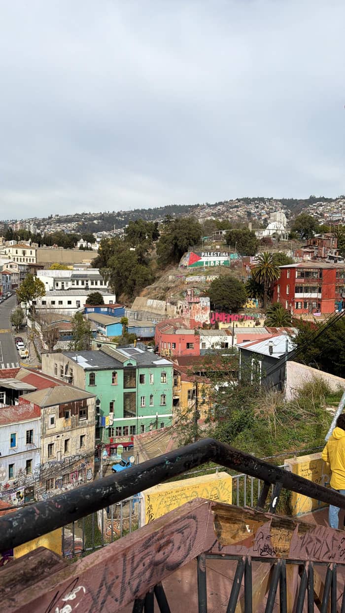
Cross into Cerro Concepción and look for the Lutheran Church of the Holy Cross, one of the landmarks the tourism board names for these hills.39 Right beside it, the Piano stairs in Pasaje Beethoven are painted as piano keys.13 Come early if you want a photo without a queue, as the tourism board advises.60
Paseo Atkinson is close by, a cobbled balcony named for Juan Atkinson, a wealthy shipbuilder and dock owner.64 Its colorful 19th-century facades show the influence of the English and German communities.14 Then drop down to Pasaje Gálvez, a lane of murals with small shops for coffee, ice cream and crafts, and peek at the Fischer stairs that join it.38,37
Finish at Paseo Gervasoni, said to be named after Tomás Gervasoni, an honorary Italian consul.65 It is one of the busiest spots in the city on New Year's Eve, when crowds gather for the fireworks over the bay.15 The view from here takes in the whole sweep of the port, and benches make it a good place to rest before the descent.
Prefer a guide?
Compare guided walks over the same hills.
Compare 3 alternatives
Compare guided walks over the same hills.
≈
View≈
View≈
ViewAll amounts are from-prices on GetYourGuide, converted at the ECB reference rate. Exact prices are shown at booking.
The loop
Start
The civic square with the Iquique monument.6
Lift up
From Plaza de Justicia to Paseo Yugoslavo.2
Cerro Alegre
Murals and a wooden footbridge.12
Cerro Concepción
Viewpoint
The whole bay at your feet.15
Lift down
The oldest lift, down to Calle Prat.16
End the loop the way the first residents did: ride the Concepción lift, the oldest in the city, from Paseo Gervasoni down to Calle Prat.16,3 The car covers 69 m in 60 seconds at a slope of 43 degrees.24 It has run since December 1883, when steam power and wooden cabins were the technology of the day.66,67
From Calle Prat you are back in the flat business district, a short stroll from Plaza Sotomayor or from Plaza Aníbal Pinto, a busy square with cafés and bus stops. If you want more, catch a micro or colectivo uphill to Cerro Bellavista, home to the murals of the Open Sky Museum and to Neruda's house.63 Otherwise walk back along the old avenues to your starting point, using the Valparaiso walking tour map above to pick the most direct streets.
The tourism board allows 3 hours for Cerro Alegre and Concepción, which matches this loop at a gentle pace with a coffee stop.4 Add an hour for the fine arts museum and half an hour or more for the boat ride. Its own longer itinerary across the hills and the port covers 14 km over 2 days, a reminder that the city rewards slow walkers.68
Video
keezi walks on YouTube · Video data is requested only when you tap play.
Begin your journey at the emblematic Plaza Sotomayor and walk to Plaza de la Justicia to board the historic El Peral Elevator.
Ready to walk
La Sebastiana, Pablo Neruda's house on Cerro Bellavista, is the classic addition. Take the Espíritu Santo lift and walk 10 minutes along Ferrari street.69 The Neruda Foundation's house museums welcome visitors from 10:00 to 18:00, Tuesday to Sunday, and the tourism board lists general admission at CLP 11,000.46,70 Book ahead on the foundation's website.71
Or go west into the oldest streets. La Matriz church, believed to date from 1559 as the first chapel of the city, was rebuilt in its present form in 1842.72 Its surroundings are called the heart of the port, because the city began there.73 Mercado Puerto, a market hall built between 1922 and 1924, reopened in 2020 after earthquake damage.74,75
From the market, the Cienfuegos stairs climb 164 steps from Calle Serrano to Cerro Cordillera, and the Cordillera lift, the second oldest in the city, does the same climb without the effort.76,47 The tourism board's funicular route comes back down by the San Agustín lift to the Mercado Puerto area, a tidy circle.77
A self-guided walking tour of Valparaiso suits travelers who like to stop where they please, photograph at leisure and duck into cafés. The streets are public, the viewpoints are free and the lifts cost only a few coins. With the map on this page, each stop has a pin and a link that opens in Google Maps on your phone.
A guide adds what the walls cannot tell you: who built which house, why so many lanes carry English names, which mural replaced which. The walk this page books lasts 2.5 hours, entirely on foot, led in English and Spanish, from $23. Another 3-hour walk of the main sights meets in front of the Hotel Reina Victoria, from $31.
Whichever you choose, keep the basics in mind. The tourism board warns that the coastal climate can be windy and suggests layers and a windbreaker, and reminds walkers to keep an eye on their belongings.59,61 At night, walk on lit, busy streets or take a taxi between the hills and the center.62
FAQ
The tourism board's hill walk starts there and goes to Plaza de la Justicia for the El Peral lift.17
The tourism board suggests 3 hours for Cerro Alegre and Concepción; add time for museums and the boat.4
The tourism board lists free admission to the Palacio Baburizza museum.23
The tourism board warns of wind and recommends layers and a windbreaker.59
A 2.5-hour guided walk in English and Spanish, all on foot.
Sources
Also worth reading
A day on the coast from Santiago? Ask a real person.